Finding Your Way Through Parks & Trails with Technology

by Sandi L. Feight-Hicks
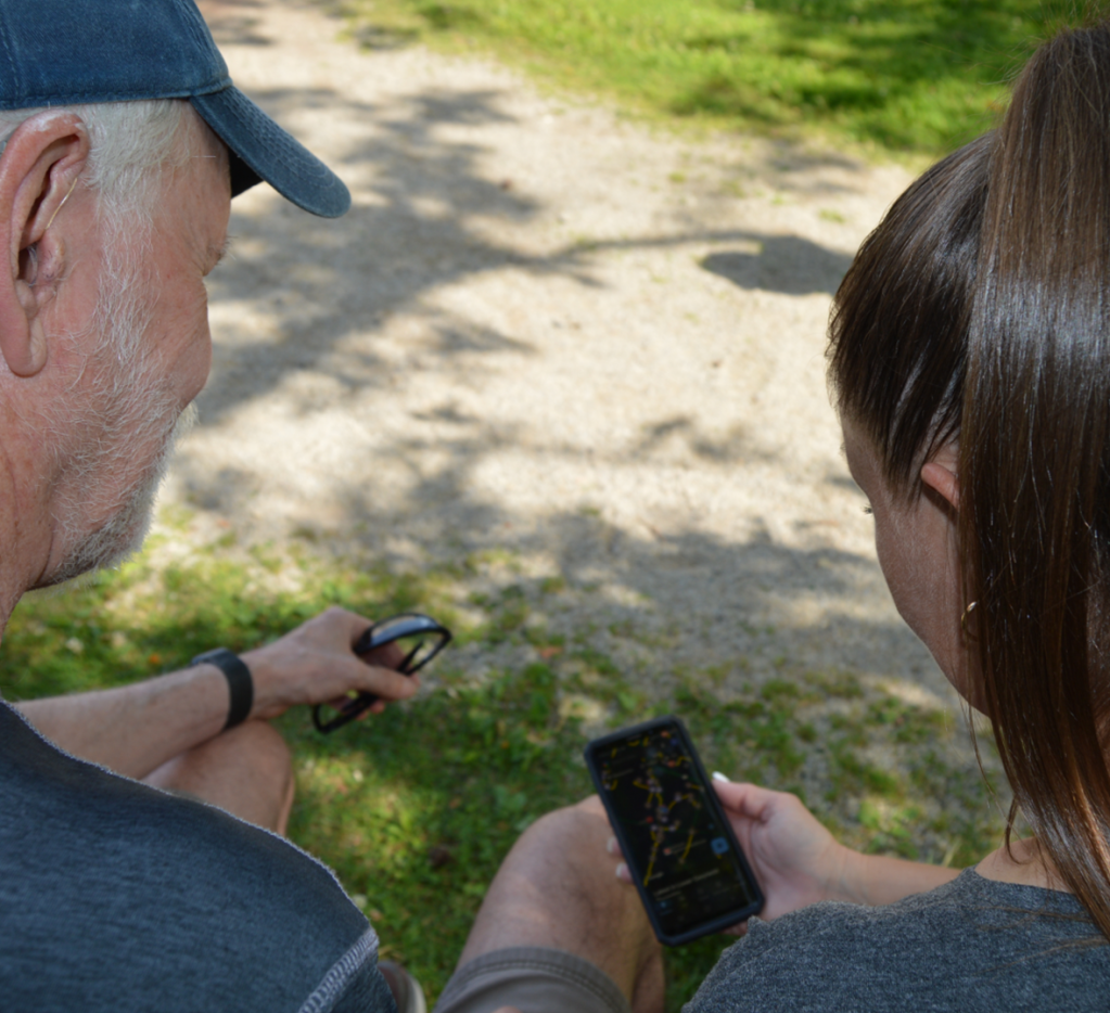
As Parks & Recreation Professionals we know every nook and cranny in our parks and on our trails. Not every person who visits our facilities and decides to walk a trail is confident where they are or understands where they are going.
Lower Gwynedd Township has over 25 miles of non-continuous walking trails throughout the community. Like any other municipality, we have paper maps with the parks, trails and street names. Once upon a time, prior to Google Maps we had written directions on our website to our parks. It’s hard to imagine a time when we had to guess where we were going. In our life time we have seen so many advances in technology.
I decided several years ago it was much easier for park visitors to use a google map to get accurate directions to our parks. After creating maps for each of our parks in Google Maps, our webmaster was able to embed those images into our website (lowergwynedd.org). Today, in total our Park maps have had over 78K views.
Since the pandemic trail use has grown tremendously, many people sought out new places to walk and explore. I can thank Google Maps for this as well, since our trails appear on the application. Since the pandemic, I have fielded many calls asking where trails are. A vast majority of the phone calls in the last several years have been, “where does that trail go?”, “I have seen this trail but not certain where it leads or ends” & “why can’t you make an interactive map?”
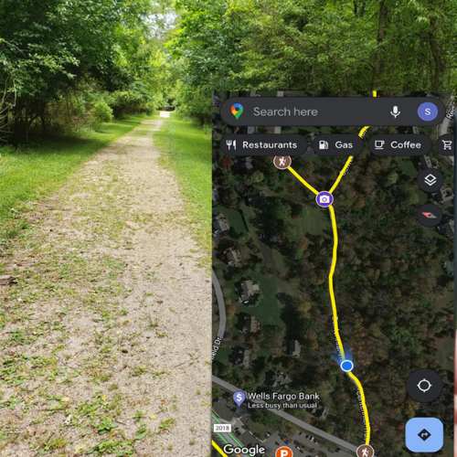
Why can’t you make an interactive map? This question stood out in my mind. I focus on users experience and how they will benefit. After finding one of the map links broken on our website, I realized I had the answer. I already had a base map with all the trails. I thought about what people inquired about; reference points, entrance, exit, junctions, distance, parking, surface materials, etc. I began to enhance the map. I defined the trail lines, “to and from”, distance, and surface material. At each trail head, I dropped a pin point, changed the icon to a hiker and added photos. At trail junctions, another pin point was added with a camera, these photos were panorama. I’m mindful of resident’s homes and backyards, as to not capture them. Parking areas were added later along with other park amenities. Using the navigation technology in Google Maps, the additional blue fan hue indicates your orientation. If you turn around, that fan will spin as well. From here you can navigate by foot to the trail head and walk the trail. In the three months the map has been live we have had over 4K views.
This map is a living document, along with the trail identification system, and it must be maintained. From a development perspective, this was not a small task, but Township Staff have the ability to make real time changes for the real time users. Our Park & Trail users now have the assurances that the interactive trail map they have on their phone and in their pocket is up to date and will show them where they are.